







What happened
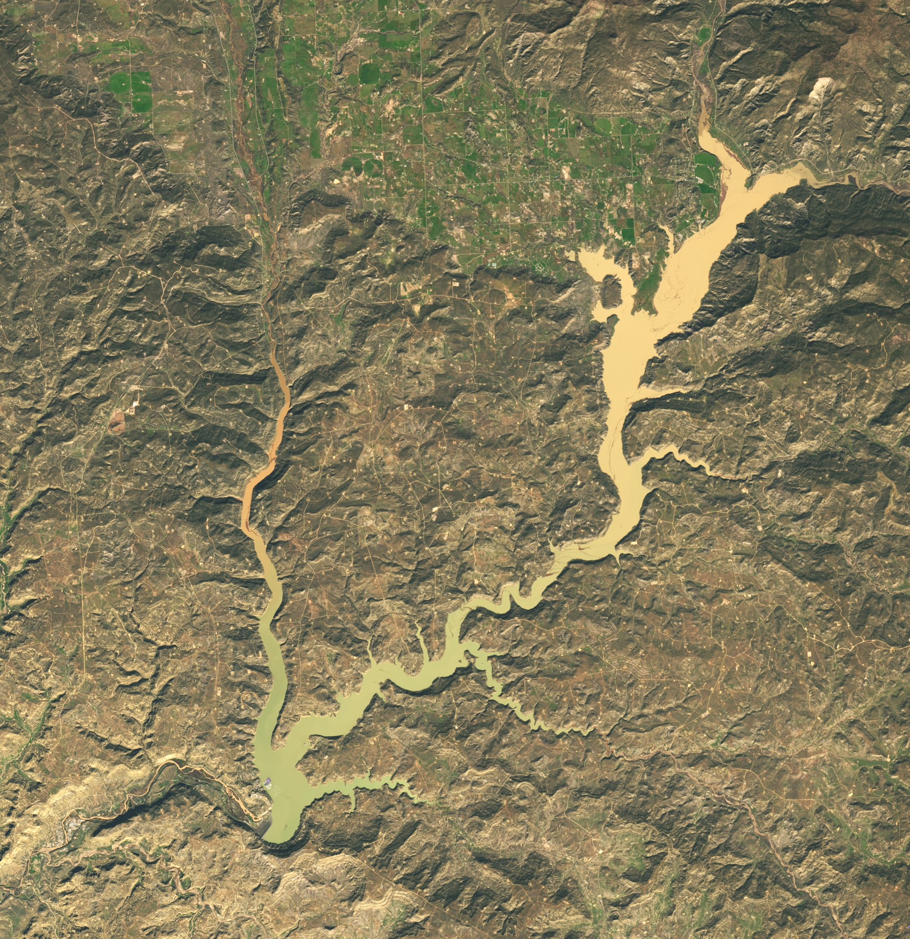
Back-to-back extreme rain events hit the Four Corners region of the U.S. Southwest in late October and early November 2026. NASA's Earth Observatory published Landsat 9 images of Navajo Reservoir, in northern New Mexico and southern Colorado, taken on 20 September and 7 November. According to data from the U.S. Army Corps of Engineers cited by NASA, the lake rose by nearly 18 metres (60 feet) in that time.
The figures
- On 7 November the reservoir stood at its highest level since August 2019, at 108 per cent of the average capacity for that date.
- On 20 September it held only 60 per cent of its average capacity.
- Little water had arrived in spring because of the snow drought of winter 2025-26.
- From early September to early November, precipitation was 2 to 4 times the average across the Four Corners region.
Floods and relief
In Pagosa Springs, Colorado, about 64 kilometres northeast of the lake, 12.8 centimetres of rain fell in the first round of storms. The San Juan River reached major flood stage on 23 October and spiked again on 1 November, nearly to the record set in 1911. Officials issued evacuation orders and, according to news reports cited by NASA, responders rescued dozens of people. The rain also eased drought: the U.S. Drought Monitor's 3 November summary said short-term drought had ended for the Southwest and the Great Basin, although long-term drought persists in places.
A possible link with El Niño
NASA notes that wet weather in the Southwest is often associated with El Niño, which can steer moisture-laden storms across the region's interior. Experts quoted by the agency said the storm system was at an unusually low latitude for the season and drew energy from very warm ocean waters.
What remains to be confirmed
This article relies on a single source, NASA's Earth Observatory. We did not check the press reports it cites.